Daily Edition Sources +3

API Discovery: Let VigiEau Answer the Water-Rule Question

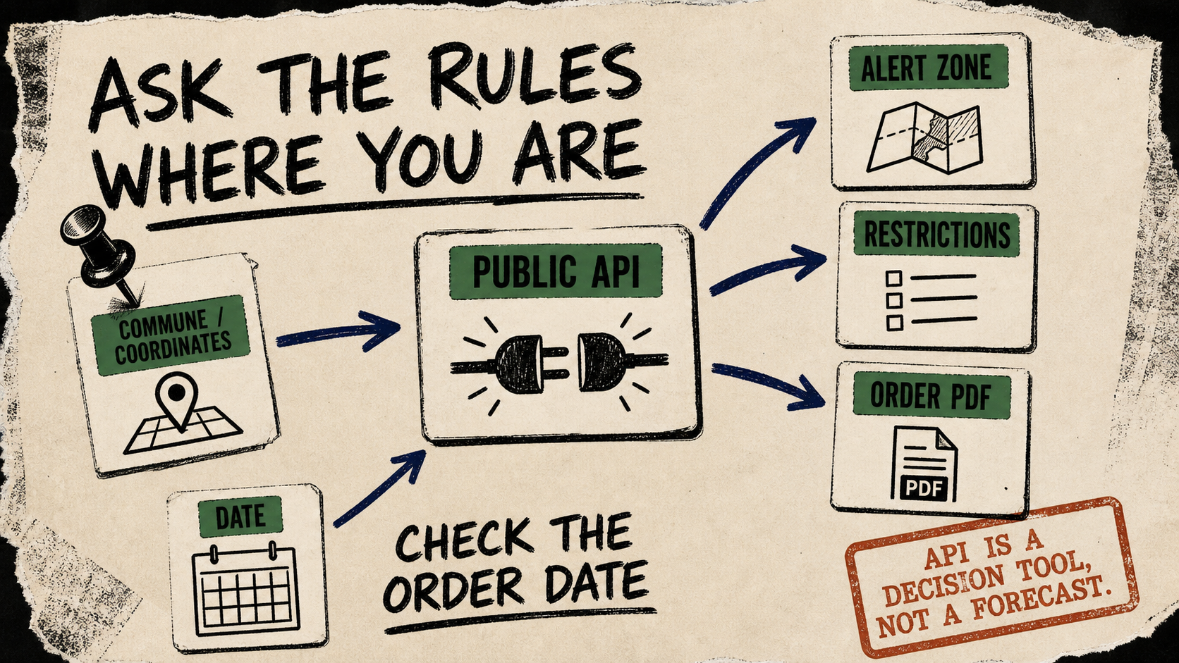
VigiEau’s public API turns a commune or coordinates into the current alert zone, restrictions, and underlying order—useful for a local service that needs to ask what rules apply here, today.

Diagram Punk poster mapping a commune or coordinates and a date through a public API to an alert zone, restrictions, and an order PDF.
Diagram Punkask the rules at a place, then check the order date.
repos source trail evidence
3 source signals 0 repos 3 source signals
Evidence: 3 source signals / July 12, 2026 / Daily Edition
Open Edition Evidence below

API discovery: France’s VigiEau API exposes /api/zones for a commune or coordinates, with optional user profile and water type. The public specification says the response can carry the zone, its severity, the restriction order, and the uses covered. The API is more useful as a decision lookup than as a generic “drought score.”

Try it

A neighbourhood-maintenance assistant could take a selected commune, ask the endpoint for the current rules, and show the relevant restriction descriptions beside the order PDF. For example, the July 12 response for Paris commune 75056 includes a vigilance-level zone, a current order with an end date, and use-specific restriction records. Treat that as a reproducible example request, not a claim about every address or a forecast.

Copy-paste agent instruction

Use the public VigiEau API at https://api.vigieau.beta.gouv.fr/api/zones. Ask me for a French commune INSEE code or latitude and longitude, then request the endpoint with profil=particulier. Summarize the returned alert-zone severity, the restriction descriptions that apply to that profile, and the order PDF URL with its start and end dates. Do not predict future restrictions or give legal advice; say when the response is empty or ambiguous.

Test caveat

The API documentation is public and the endpoint accepted the sample request without authentication or an API key during this check, but access availability can change. Restrictions are time- and location-sensitive, an address may map to several water-resource zones, and the response points to an underlying order rather than replacing it. Recheck the returned order dates, data freshness, and the official PDF before taking an operational action.

Evidence Trail

Receipts below the story

The article above is the public narrative. This section keeps the source trail and limits on the same page.

Edition
DateJuly 12, 2026
LaneDaily Edition
Confidence78%
Sources3
Repossource trail

Primary Evidence

  • Public API source: https://api.gouv.fr/les-api/api-vigieau
    • Shows: the VigiEau public service is an open API for finding water-resource severity and restrictions by address, profile, or water type, with the provider’s API surface described for public use.
  • Supporting definition or documentation: https://api.vigieau.beta.gouv.fr/swagger
    • Shows: the OpenAPI documentation defines the /api/zones request parameters for commune or coordinates and response fields for the alert zone, restrictions, order details, and user profiles.
  • Same-day request example: https://api.vigieau.beta.gouv.fr/api/zones?commune=75056&profil=particulier
    • Shows: the endpoint responded without authentication during this check with zone severity, restriction records, and an order PDF URL for the supplied commune and profile.

Evidence Limits

  • The response is location- and date-sensitive, may include more than one resource zone, and points to an official order rather than replacing it. No availability, rate-limit, or legal-advice guarantee is implied.
Letters & Corrections

Send a note to the desk

Corrections, missing context, or a follow-up lead.